30 December 2012

SCENES FROM A RUN: EAST RIVER PARK

Some years ago, while waiting for my son and his swimming lesson, I discovered East River Park, the park that runs below the Williamsburg Bridge.  I love the idea of running the length of Manhattan Island and soon found the chance to head north from East River Park.  I was soon disappointed as around 30ish Street the waterfront ended.  Somehow I was convinced that the United Nations building, supposedly on its own land even though it is on U.S. soil, didn't allow the waterfront to go through it.  I really wanted to go inland and find out where the waterfront would begin again but never had the time to.  I may have gone back to the same route, but only to go back south.  Sure I can look it up on the map, but exploring in person is more interesting.

A few days ago the chance came.  I had about three hours to spend on my own while son and wife were in back-to-back music lessons.  I parked near the amphitheater in East River Park and walked over to the restroom near the tennis court, used the facility, stretched then off I ran.  Up along East River Park I went, over the metal section where a little cove existed below, out of the park past the narrow section created by some Con Ed facility, through Stuyvesant Cove, the Water Club, some helicopter port, then a ferry stop.  I didn't recall seeing the ferry stop on my last visit and thought that was the end of the waterfront, but upon seeing some cyclists heading further north I followed them.  Then memory of the East River Esplanade came back to me.  If you associate the word "esplanade" with the Brooklyn Esplanade, you know, that park that overhangs the BQE, you will be disappointed.  It is not that long, a mere city block at most, maybe even less.  But that is the end of the waterfront, 37th Street to be exact.  With more time this run, I headed inland and continued up First Avenue.  For those who don't know, the U.N. building is at 42nd Street, so the waterfront actually ended about five blocks before hitting the U.N.  Maybe it's a required buffer zone, maybe it has nothing to do with the U.N.  On First Avenue, I passed Bellevue Hospital and one huge vacant lot that I am sure some day will be the home of some building.  At the intersection of 42nd Street and First Avenue, I paused to take a photo of the Chrysler Building, with Tudor City in the foreground.  I don't remember how I came to know Tudor City, but it is interesting to me because it is on a hill overlooking the U.N. and nearby area.  I thought it is the only such area in NYC but soon found out otherwise.

The U.N. complex takes up a few blocks, which is a good thing for me as I like to be able to run as continuously as possible, without having to look for traffic at intersections.  The only down side is it was a popular tourist spot, even on a cold day, so I had to weave around them visitors every now and then.  At 49th Street I made a right turn to head for the waterfront and arrived at the closed gate of Peter Detmold Park.  It was closed, but not locked.  There was a sign asking park-users to make sure the gate is closed, I supposed to keep wandering children, or dogs, to get out of the park, without their caretakers' knowledge.  Any normal adult would know to pull the meter rod to open the gate.  Detmold Park is really narrow, just a little strip of land immediately next to the FDR Drive.  It seems to be a popular spot for dog-walkers, as there were a few of them, dogs and their people, in the park.  The great thing with Detmold Park is within is a series of steps leading to a footbridge over the FDR to get to the waterfront again.  I shall travel all the way up to the tip of Manhattan, so I thought.  Regrettably, the waterfront at this point only runs for a few block.  I vaguely recall the FDR being expanded out onto the water some years ago.  Maybe that expansion cut into the waterfront park.  Oh well, in a future run, I will find out where the waterfront continues after this break just before the Queensborough Bridge.  At least for this run, I discovered another town-on-a-hill.  From Detmold Park, I went up to the town and ran downhill to get back to the U.N. area, then further south back to East River Park.

I love these over-the-water sections of the East River Park.  Looking down you see the water and land-ward there are rocks and old logs to give the place a quaint country atmosphere.
A section of the east waterfront near 14th Street.
Welcome to Stuyvesant Cove.  For this run, I used the trail paths on the way north and then used the pavement on the way south.
Trail-running in the big city!  Not that much of a trail, but something different to have briefly.
The ferry stop is on the right of the photo, I thought this was the end of the waterfront, but the road on the left led me a little further north.
East River Esplanade, not an esplanade in the sense of Brooklyn Esplanade, but still nice.
East River Esplanade sign.
The intersection of 37th Street and a north service road for the FDR Drive.  Through the underpass runners and cyclists can continue their southward journey.
Don't be discouraged by the closed gate of Peter Detmold Park.
Peter Detmold Park is narrow, with the FDR right on the other side of the fence.
The footbridge that will lead me to the waterfront, to continue my northward journey along the water.
Steps leading from Detmold Park to the footbridge.  You can also go further up to that other town-on-a-hill overlook the FDR.
To the water, let's go!
Northward bound.
Rats, foiled again!  The east waterfront ended, again, with the Queensborough Bridge in sight.

My free education at The Cooper Union was partly financed by The Chrysler Building.  The school owns the land on which the building stands.
I took a little time out to take a photo of the U.N. building for the #1 fan of my blog.

26 December 2012

SCENES FROM A RUN: MARINE PARK SALT MARSH WEST TRAIL

I thought Google already has everything categorized and indexed, but that is not the case with the nature trails in Marine Park's Salt Marsh.  A few weeks ago I discovered that the nature trail at the Salt Marsh was re-opened, http://www.qaptainqwerty.com/2012/11/scenes-from-run-salt-marsh-trail-in.html.  I made the loop but at the southeast corner I saw that there was some path leading potentially all the way to the Belt Parkway.  I didn't have time to explore the path.  A few days ago, I tried to find more info about that elusive path but it didn't seem to exist.  Aerial views from different map programs don't show any such path.  Maybe it's not an official path.  What I discovered by chance though is that what I thought was THE trail is just one of two trails in Marine Park.  It was the eastern loop that I visited.  I was aware of some other path that runs along the water and Burnett Street, but I didn't know that it's so long.  Why, it's the western trail!

For today's run, I went mostly along Avenue X to Burnett Street.  I really wanted to find the official entrance to the trail but going along Burnett toward Avenue U there was no entrance to be found.  There were no breaks in the low rail.  It would be easy to step over the rail and in some places there were clearing immediately on the other side of the rail.  Eventually I found the entrance, as shown below, on Avenue U.  A man with yarmulke told me that there was only one entrance and one exit and this was it.  In other words, you go in here and supposed to trace your way back out.  From what I saw on the web, the trail is pretty long, so I was sure there must be some other way to leave the trail, official or not.  I went in anyway and soon hit the beach.  And the mud and other terrain.  A runner who I saw on the road earlier running in the other opposite direction re-appeared in the marsh, also running in the other direction.  I shouted to him asking him how he got in but he had headphones and was oblivious to me, or maybe he didn't want to acknowledge my presence.

At the intersection of two paths, I met a man walking a white dog coming from street-side.  Just to be safe, I asked him if that was the only way to get from Burnett Street to the trail.  He said there were other exits and headed further south, ahead of me.  I decided then that I did enough exploring for this cold day and headed out.  Sure enough, just around a big pile of branches and such I soon reached the street.  There was not an opening in the low rail, I just had to step over it.  I noticed that there was a piece of yellow police tape on a tree near the "exit".  Maybe it's supposed to guide hikers where to enter the trail.  I am sure I will be back, perhaps on a nicer day, to explore the rest of the trail.

By the way, one thing I discovered from my online search for info about Marine Park is that size-wise Marine Park is actually bigger than Prospect Park.  Maybe not more beautiful in the traditional way, definitely not runners-friendly, but surely many acres bigger in size.

The entrance to the west trail of Marine Park Salt Marsh, on Avenue U near Burnett Street.
The pilings in the water was used when there was a mill in the area, whatever the use I don't know.
Maybe on a nice sunny day, this area can make a good picnic mattress?
This yucky terrain reminds me of some scenes in the Chinese classic literature Water Margin: Outlaw of the Marsh (水浒传)
This is the kind of path us runners like.
A glance back at the trail I just left.
No sign to indicate this path as a way to reach the west trail, other than the yellow police tape on the tree on the left.

23 December 2012

SANTA AND CAROLERS

It's strange how things just fall into places.  A few weeks ago I decided to join a walking caroling group in Jackson Heights on Saturday 22 December.  In a Santa suit, mind you, as Santa Claus, not to sing, since many people, including my wife and my son, already told me I always sing off-key.  My father had the singing talent, and so does my son, so I guess the gene skipped me.  Anyway, one reason I wanted to attend the event was that my Facebook friend James M was attending.  James and I went to the same high school (Newtown High in Elmhurst, Queens, New York, not the one in the news that's related to the mass murder) but it was a big place so we only knew each other, virtually, via Facebook about 25 years after we graduated high school.  So I went mostly to meet James for the first time, in person.  A secondary reason was that I lived in Elmhurst, which shared a border with Jackson Heights, so I also wanted to re-visit the area.

As the day of the event approached, I found out on that I would need to play chauffeur for my wife mere hours before event time.  It was possible that I would be stuck with that duty and miss the event altogether.  I told the organizer that I definitely would not be there by 7 P.M., but I will try not to be too late.  Then my new blog fan TbirdOnRoute66 made some encouraging remarks about traditions so I was even more eager to go.

It turned out my chauffeur duty was done early enough in the evening for me to leave the house in ample time.  Well, except that traffic on the Van Wyck Expressway was bad so I took Woodhaven Boulevard, but as I neared Queens Center Mall traffic on Woodhaven was bad, too.  By 7 P.M. I was still on Woodhaven, inching slowly forward.  The only saving grace was that I was in full Santa costume so as different cars pulled along me, I would silently greet them.  Everyone was happy to see Santa.  In some instances, I even pretended to mistakenly have my fake beard-and-mustache on my neck, look panicky when someone saw me, as if I just realized the missing beard, turn away then put the beard in the right place.  Spreading joy and laughter on Woodhaven Boulevard in stop-and-go traffic!

I eventually arrived at the meeting place and managed to get together with the carolers.  And met James, along with a few other people I vaguely knew from the various Facebook groups.  My Santa suit didn't have room for a camera so even though I brought one it was left in the car.  Luckily, James had a camera and we even had a videographer, Joe D.  Below are some photos from the event courtesy of James and Joe.

Joe, Santa, and Vinny in Waldbaum, Aisle #2.
Santa and James.


See other videos Joe produced at http://www.youtube.com/user/66cats77?feature=watch

21 December 2012

MERRY QRISTMAS!!!

As far back as I can remember, Christmas is for the kids.  Or specifically, Christmas presents and parties.  I am not even religious and only do things like hooking up the lights and adorning the Christmas tree just for decorations.  Some years I even dress up as Santa to give out presents, to the kids (my own, nieces and nephews), just for fun.  I think I told them the true meaning of Christmas but not sure if they remember it.  Apologies to the Religious Right.

In recent years, the festivity has decreased in intensity.  No more Santa suits, the kids know who man really is, it is no longer fun for them.  Kids have other interests in life and don't want to help out with decorating the Christmas tree.  I think some years we didn't even have the tree up.

I finally got the tree up this week, but was hoping some kids would help me decorate it.  None came forward, so I did it all myself today.  At first I was going to put up just a few globes but then I thought this might be the last year I will do it.  Not because of the kerfuffle with the Mayans.  So I went all out and used every ornaments found in the box.  Then I recalled an idea I got from Runner's World magazine's Facebook page.  Race medals!  I only have a handful but I think it's just about right.

Qaptain Qwerty's 2012 Qristmas tree.
A different view of the Christmas tree.
Close-up to show the medal from the inaugural Brooklyn Marathon, 2011 and in the shape of the Grand Army Plaza arch, on the right.  The 2012 Brooklyn Marathon medal is on the left, which showcases the Brooklyn Bridge.
Close-up of the Yonkers 2012 Marathon medal, in the shape of New York State.
I live in Queens for over 13 years, so it's my second favorite NYC borough.  The Queens 10K medal features the Unisphere of Flushing Meadows Park.
The Bronx 10-Mile medal shows the gate of Bronx Zoo.  What would be a better icon to represent the Bronx?  I don't know.  Along with Staten Island, Bronx is among the least-visited boroughs for me.
Sigh, I sure was hoping to run the NYC Marathon a third time, but Sandy dashed that hope.  At least I will get my money back.


For photos of a medal tree submitted to Runner's World, visit
https://www.facebook.com/photo.php?fbid=10151146401671987&set=a.331864511986.156956.9815486986&type=1&theater

Look at other photos in Runner's World Timeline in Facebook while you are there.

Thanks go to my #1 Reader, TOTA, for sending the Christmas tree and the ornaments.

20 December 2012

FUN IN REFUND

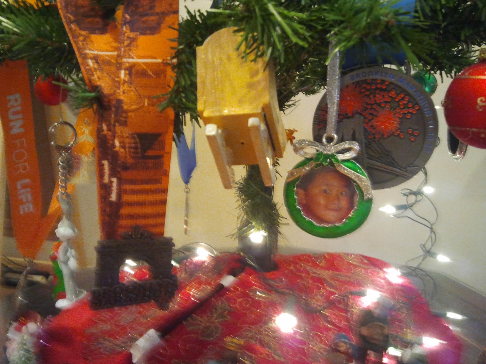
There is a runner in Bath Beach
With no income, he ain't rich
Guaranteed entry?
No! With refund, you see
Each meal, for life, bánh mì sandwich!


Good news came from the New York Road Runners today.  After about two months of little news, NYRR finally announced that any runners who were scheduled to run the 2012 NYC Marathon, but couldn't because it was cancelled at the last minute, have the options to get a full refund, minus the $11 processing fee.  Other options are 

  • not get a refund but get guaranteed entry for the 2013, 2014, or 2015 marathon, but pay all over again, albeit at 2012 price
  • not get a refund but get guaranteed entry for the 2013 NYC Half Marathon and, again, pay for everything all over.

As the runner from Bath Beach with no income, I'll jump onto the refund option.  Road races always carry a no-refund policy, but NYRR made an exception for this unusual circumstance.  Maybe the deal struck with their insurer will cover everything, maybe 50% will be covered, who knows?  All I know is it's a good deal for people who can use the refund.  Good P.R. for NYRR! P.R., in this case, of course, means public relation, not Personal Record, Mr. and Ms. Runner.

From what I saw on Facebook, it seems many people don't mind foregoing the refund to secure a guaranteed entry.  And paying all over again, even if it'll be 2012 price.  Hmm, the mention of "2012 price" makes me think price will go up in 2013 and so on.  Price increase or not, that's still one stiff price to pay for a guaranteed spot.  I suppose if people don't have the time to do 9+1 then it's comparatively less costly to just "buy" a spot with the money already spent on the ill-fated 2012 race.  At the wild number of $30 a race, doing 9 races can set you back $270, as opposed to the $200+ already spent on the 2012 NYCM.  Personally, I'd rather do the 9 races and get something more out of it, including a way to gage my training.


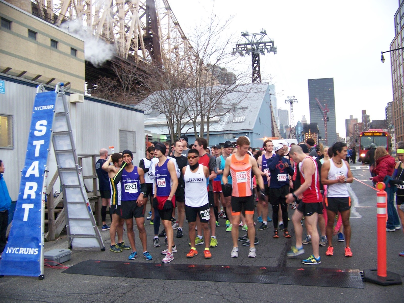
The NYC Half option is even less attractive, in my opinion.  From what I read, last year the NYC Half ran through Times Square and ended with a party in the South Street Seaport, all for a mere $100+ fee etc.  Again, you sorta buy a guaranteed entry for the NYC Half.  Quite a popular race, the NYC Half also has a lottery system and its own system for guaranteed entry.  One way to get into the NYC Half is to participate in four out of the five five-borough race series.  I did all five in 2012, including the Manhattan Half Marathon that became a fun run because of snow, for which I got race credit even though I was home shoveling snow.  I had guaranteed entry for the NYC Half but I passed the chance to spend $100+.

One common confusion is that the Manhattan Half and NYC Half are the same.  They are not, even though both takes place entirely in Manhattan.  NYC Half is touristy and happens in Central Park, Times Square, West Side Highway, then South Street Seaport, in March when the weather is usually nice.  Manhattan Half happens entirely in Central Park and is scheduled for the cold month of January.  It also costs less and anyone can sign up provided it is not already sold out.


With the end of the year approaching, nothing will actually happen yet with the refund etc.  Some email will be sent out January 10 of the new year and the runners will have some window of time to make the selection.  It would be real bummer if the world will really end tomorrow, December 21, 2012.  Wonder if I should ping some Australian or Asian people I know.  It's already December 21 there, right?

Farewell, cruel world!

For the exact wordings from ING, the sponsor of the NYCM, visit http://www.ingnycmarathon.org/resolution.htm

18 December 2012

PERSONAL TRI-BORO BIKE TOUR, PART TWO

Before moving to Brooklyn in late 1990s, I spent almost ten years living in Long Island City, Queens.  Many times I would drive along 11th Street to get to the Pulaski Bridge, to eventually get on the BQE near McGuinness Boulevard.  On my way to the Queensboro Bridge a few days ago, I thought I still knew my way around the area on the Queens side of the Pulaski.  How hard can it be to travel the area on bicycle?  How different can it be compared to driving?  A lot, especially if you want to obey traffic rules.

After crossing the Pulaski, I saw a bike lane going toward the river and took it.  I thought it could not go wrong to follow the waterfront, which was on the left.  At some point though, I saw that the Queensboro Bridge was on my left instead of being in front or to the right.  Something had to be wrong, I must have made a wrong turn somewhere!  Luckily, not long ago I visited Gantry State Park and knew that Vernon Boulevard runs all the way north, under the Queensboro.  Once I found Vernon, I was on track again.  When I got under the Queensboro, I should have turn right immediately but instead I went straight.  Maybe I did that because I knew from a visit to Sunnyside some years ago that the ped/bike lane of the Queensboro was on the north side of the lower level of the bridge.  Unfortunately, there were no other right turn to take because of the buildings of Queensbridge housing project.  I ended up having to go the extra distance to 41st Avenue.  Eventually I found the bike ramp for the bridge.  Cyclists are supposed to use the left lane while the right lane is for pedestrians.  There were not that many people and the walkers, and the occasional runners, were all over in either lane.  As I slowly made my way up the ramp, it occurred to me how is it possible that I saw land below the bridge, but I was not done with the ascend?  In other words, if the Queensboro Bridge connects Queens and Manhattan, as soon as I see land under the bridge, as opposed to water, should I not be descending the bridge already?  Then it dawned on me.  I was mistaken, for the land I saw was not Manhattan, but Roosevelt Island, the very place I will be running the NYC Runs Hot Chocolate 10K on.

When I finally made the descend, I saw the sign to indicate a steep descend and slowed my progress by braking slowly.  It was a good thing I did because the path took a nasty U-turn at the end of the ramp.  If I was coasting downward I am pretty sure I would not navigate the U-turn in time to avoid a crash.  Maybe I missed some sign that warned "Sharp U-turn ahead!"

Off the Queensboro Bridge, I was already at First Avenue and 60th Street.  I should probably just walk the bike over to Third Avenue and whatever 60ish Street but I rode anyway.  Right away, I didn't like it.  Just a block north there was a truck blocking the bike lane.  As I stopped to look to behind me before passing the truck, some cyclist zoomed by.  Not close enough to hit me or anything, but it got me shaking my head.  Maybe the cyclist already looked behind and saw that the coast was clear.  The short trip across the avenues and the few streets were slow and at times I did walk the bike.  I was glad to find one of those CityRack but then I couldn't find The Running Company.  It turned out my memory failed me and I was off by just one block.  Got the bib and souvenir mug (instead of T-shirt), for myself and another PPTC 10K runner, and off I went.  I would love to ride back to Brooklyn but the trip to the store already took about two hours.  I was needed elsewhere so I had to take the subway back.  Bike trips are great as long as you are not in a hurry.  Or the distance too great.  Or the weather is not too nasty.

I definitely need to re-visit Kent Avenue and the Pulaski Bridge to take some photos.  I also totally passed by East River State Park.  I think I often saw it from across the river in East River Promenade under the Williamsburg Bridge.  It looked like a nice place to take a stroll or just to relax.

17 December 2012

NYC RUNS HOT CHOCOLATE 5K/10K 2012

Much as I would love to give you details of my bike trip in Queens and Manhattan, i.e. the second part of the PERSONAL TRI-BORO BIKE TOUR, I need to pre-empt that writing to bring you the latest in my road-running adventure, the NYC Runs Hot Chocolate 5K/10K...

So we know the personal tri-boro bike tour was for me to go get my race packet, which consisted of a mug and the bib, as pictured below.  Much as I love T-shirts, I must admit that I do have quite a few already so having a mug as a race souvenir was a good thing.  It is also good that the time tag was attached to the back of the bib.  One fewer thing to worry about, i.e. unlike the D-tag, there is no need to attach the tag to the sneakers.  Of course, the down side is that on the subway ride over to the race, while waiting on the subway platform, without the D-tag sticking out from the laces on the sneakers, it is not easy to tell who your fellow runners are.

The subway ride to Roosevelt Island was uneventful, and that's a good thing.  Earlier in the weekend, I noticed a sign saying there would not be Coney Island bound service.  By Sunday morning, however, the token clerk wrote "Normal Service" on the whiteboard in the token booth.  Not that I dread a little longer walk from the N train station after a 10K, it was good to know.  Many years ago, Roosevelt Island was accessible only by tram or by foot/car via the bridge from Queens at 36th Avenue and Vernon Boulevard.  I did take a tram trip just for the fun of it and still have the tokens I saved as souvenir.  Nowadays the F train has a stop there, aptly named "Roosevelt Island".

The 10K race was scheduled for 10 AM but I wanted to be early to take photos of the 5K runners.  I also picked up race packet for a PPTC member.  I emailed her once I got out of the subway to tell her that I would wait for her in the subway station, away from the cold rain.  She called me back a short time later to ask me to meet her at registration area, near a mutual Facebook friend.  Mug and bib transferred to its owner, off I went to do some stretching and mingling in the crowd to greet PPTC friends and NYC Runs officials.

I took a few photos of the fast runners lining up for the 5K then walked down the corral looking for PPTC members.  Found one and took her photo and just as I was still at the end of the corral the race started.  I rushed back to the front and snapped a few, uh, blurry photos.  It must be the overcast sky and the lack of a working flash on my camera.  Next time I'll use my wife's still-flashy camera.

I had some time to kill before the 10K race started.  Walked around a bit and took photo for a different PPTC member as well as those of the runners milling about waiting for their turn.  I wanted to take a picture of the front-runners for the 10K race, too, but I didn't want to risk having my bib mistakenly picked up at the start mat.  I am perfectly fine with running from the back of the corral, but it would be bad if my time starts at the mat before I actually run across it.

Hurricane Sandy brought about some damages to Roosevelt Island so the course had to be changed.  I was a bit worried that I would get lost somewhere along the slightly different course, but good thing there were volunteers etc along the way to guide the runners.  I was with the bulk of the runners all the time too so I was able to follow the runners in front of me.  I typically run at least 8 km so the 10 km race should not be a big deal, but after a few Ks I did wish it would be over already.  I suppose running on the street I had many forced stops, at unfavorable traffic lights and such, perfect time to catch my breath.  In a race, the road is usually closed for us runners so there's no excuse to stop, unless the body cannot take it any more.  And my body sure could take it!  I ran continuously, through the light rain.  There was some dirt road in the northern part of the island and runners were advised to wear old shoes for the race.  Luckily, it didn't rain that heavily so we didn't have a muddy path to deal with.  I was a bit cold in the beginning but by 5K I felt I had too many layers on.  The course was advertised as flat, perfect scenario to get a personal record.  At the NYRR Queens 10K my time was 1:07.  When I was within earshot of the cheering from the finish line, I started to sprint to end the race.  I was hoping I would beat the few people in front of me but too bad they too stepped on the gas.  I still had a new PR for a 10K, 1:02:44, although I was told later by other PPTC members that had I ran through the finish mats, instead of pausing to stop the GPS watch, I could have shaved 5 more seconds from the finish time.  Oh well, next time, next time I will.


Souvenir mug and bib.  I even brought the mug to the race planning to use it, instead of a Styrofoam cup, so just in case there were other mugs I attached a piece of swimming pool wrist-band to the mug handle.  I got lazy and used a Styrofoam cup after the race though, sigh.
If you run 8 minute-mile or better, you get to be in the front.
Off them 5K runners went!
Race officials setting up the 10K start, which is a short distance from the 5K start.
10K runners already hanging out in the corral.
I normally have a fanny pack across my chest to hold house keys, cell phone etc, but for the Hot Chocolate Run, since I wanted to take some photos before the race and after bag-check, I had a separate fanny pack to hold the camera.

More photos can be found at

https://plus.google.com/photos/109153989599275468311/albums/5822721934907065953?authkey=CJ-Bwe7KyciiOQ

15 December 2012

PERSONAL TRI-BORO BIKE TOUR

This morning I traveled by bike to The Running Company on Third Avenue between 62 and 63 Streets in Manhattan to pick up my bib and swag for the NYCRUNS Hot Chocolate race on Sunday.  While the location is not as convenient for me as, say Jack Rabbit Sports in Park Slope, it was a good chance to explore northern Brooklyn and southern Queens on two wheels.  Originally, I thought about entering Manhattan via the Manhattan Bridge then go north along the West Side bike lane.  On second thought, since the store is on the east side of Manhattan and just a few blocks north of the Queensboro Bridge, the Queensboro would be the better choice.  So my goal was to go over the Pulaski Bridge to get into Queens, then the Queensboro to get into Manhattan.

As usual, I started out by heading to Ocean Parkway and traveled most of its length northward, into Prospect Park and went with traffic flow, counterclockwise, to get to Grand Army Plaza.  I hoped I would bump into some PPTC members running in the park but none was found, at least no one I know, that is.  After PP, I went along Vanderbilt to get to past the elevated BQE.  Vanderbilt south of Atlantic Avenue is bike-friendly, but north of Atlantic Avenue it is a shared road.  Good thing there were two other cyclists in front of me, so I just quietly followed them.  I also thought of Transportation Alternatives' bike train, whereby veteran cyclists lead novice ones on rides through the city.  What a great idea!

I don't know the Williamsburg area well enough but enough to know that I had to avoid being south of the BQE.  From the few times I drive through the area, I know that it's somewhat commercialized and can be busy and crowded at many places.  The BQE being dipped below street level does not help either.  As soon as I hit the BQE, I went under it and got to Flushing Avenue and the Brooklyn Navy Yard.  I probably passed through the area before while riding in the Bike New York Tour, but have no recollection of the scenery.  Again, some cyclist happened to go to my right, which I was sure that I should turn right too, so I followed him.  Just past some gate into the Navy Yard, on the opposite site of the street was a protected bike lane, with the protection in the form of cement barricades.  Sweet!  Even better, after a turn into Kent Avenue, there was a sign that tell cyclists to use the sidewalk!  I love Kent Avenue!  Though the sidewalk bike lane ended at some point, the bike lane became protected, with the parking lane being the protection this time.  At many corners cyclists are supposed to watch out for cars turning left, but with the East River on the left, most of the times the left turn would lead to a dead-end, so few cars actually made the left turn.  Or maybe it was too early in the day.  I aimed to get to the store by 10 AM and left home around 8.

I left Kent Avenue for North 14th Street, thinking that I would hit McGuinness Blvd. eventually.  Unfortunately, there was no bike lane on McGuinness and with the calming median and the parked cars, there was just enough room for two cars to go side by side, not an ideal situation for a bike to squeeze into.  I went toward the Pulaski Bridge via Newel Street, but at Greenpoint Blvd. it ended.  Back on McGuinness, the Pulaski was just three blocks away but again I don't want to fight with the motorists.  So I walked the bike the three blocks.  Not just a cyclist, I'm also a runner and walker, when the time comes, I can easily walk.  At the foot of the Pulaski, I discovered that Eagle Street would be the better choice over N. 14th St.  Live and learn!  That's what I love about actually going out there to discover what works and what does not.

I was worried that the Pulaski bike lane would be like the Marine Parkway, i.e. that the bike should be walked, at least according to some signs I saw some time ago.  Luckily, it's a ped/bike shared path and that bikes should go slow.  They sure should, as the lane is pretty narrow, just enough for two people or bike to squeeze past each other.  I traveled over the Pulaski Bridge many time by car and once by bike, on the vehicular road, during Bike New York's tour.  For today's first-time trip over the bike lane, I discovered that in addition to the ramp, there are stairs, with many steps I am sure, to get to the bridge, on both the Brooklyn and the Queens sides.

I made it into Queens!  Just a few more kilometers and I should be at the Queensboro Bridge.  Once I cross into Manhattan, my target would be just a few blocks away.  Before moving to Brooklyn in 1997, I lived in Long Island City for about ten years, so I know the area near the Pulaski Bridge pretty well.  Or so I thought.

14 December 2012

BOO TO BIKE BAN ON BRIDGE!

I recently went out to the Rockaway to do some volunteer house-cleaning work.  Muck-out is the term they use.  The houses got flooded during the storm, especially the basement, everything is ruined and needs to be thrown out.  It was sad to see boxes of stuff containing memories precious to the owners being tossed to the curb.  Or a whole room with bookcases tipped over, content from the shelves spilled haphazardly all over the floor.  For a pack rat like me, it was quite a horror.

One thing I love about running and cycling is to know the amount of time it takes to go to a specific place.  I admire people who can look out at the horizon and roughly estimate the distance to a place.  I have to personally travel over the distance with some measuring device, or measuring the distance afterward on a map.  With my regular running, I now know how long it would take me to run to a certain point in my neighborhood.  I am still relatively new to cycling and often wonder how long it would take to go to the Rockaway.  Years ago I went as far as Breezy Point gate or some other street on the east side of the peninsula, but I don't remember now how long it took me, or how far the distance.  For this week's trip, the distance from my home to Beach 129ish and the main road was about 16 km (10 miles).  It took me about an hour and 15 minutes.  I am happy to report that there was no sign on either approach to the Gil Hodge Memorial Bridge reminding cyclists to dismount and walk their bikes.  Maybe the signs were knocked down by Hurricane Sandy and the government hasn't gotten around to re-erecting the new ones.  All the times I used the bridge, only once did I see someone walking the bridge, I don't see the point of not letting cyclists ride on it.  Supposedly in the summer fishermen use the bridge but then cyclists can just common sense to walk the bikes past these guys, no?

The trip back took a little longer, both because I strolled on Plum Beach's newly reclaimed beach and because of heavier traffic.  Not long ago, beach erosion has encroached so much of Plum Beach, where the bike path enters the parking lot, that sandbags had to be placed to temporarily to hold back the water.  A few weeks ago, before Hurricane Sandy, I noticed that the sand went much further out into the water.  It's good to see that the beach was reclaimed but too bad the bike path is still under lots of sand.  Perhaps that's one effect of Sandy, doh!

I headed home during the evening rush hours so once I got off the bike path near Knapp Street, there seemed to be no way of avoiding vehicular traffic.  Emmons Avenue is bike-unfriendly, so was Avenues Z and Y.  How I wish the Boardwalk is open to bike traffic outside of 5 AM to 10 AM.
Two things I like:  large solar panel and my bicycle.
Star of Hope reads: Courage is every virtue at its testing point. (Yes, I took the liberty to correct the wrong use of "it's".  I also removed the contact info for the electrician, don't want to give them free advertisement.)
Group photo, with the house owner, after a day of mucking.  Who cares?  New York Cares!
Plum Beach with a few tons of sand recently dumped on it to reclaim the beach from erosion.  Not that far ago, mere meters from the highway was where the water has approached.
Sandbags to salvage the beach.

12 December 2012

WELL WELL WELL 12/12/12!

December 12, 2012, aka 12/12/12 has come and is almost gone, and nothing significant happened.  Except perhaps that benefit concert that's all the buzz on my Facebook friends' walls.  I did not do anything different, other than set out to run 12.12 km instead of the usual 8 km.  I thought about running 12 hours 12 minutes and 12 second but I never ran that long before and there was not that many free hours in the day anyway.  Another option was to run 12.12 miles, which is equivalent to almost 20 km, which I could do in less than 2 hours and 15 minutes, but 12.12 km worked for me.

It's been a while since I ran to Fort Hamilton High School so that's where I aimed for.  I ran mostly along 85th Street, up Dyker Height's great hill between 12th and 11th Avenues.  When I felt like doing hill training I would run up and down the hills while moving a street over, i.e. up 85th St. then down 84th St., then up 83rd St. and down 82nd St.  Three sets of up and down was the max I ever did.  Today, I didn't want to get off-course so I went straight to 7th Avenue, over the foot-bridge that spans the Brooklyn Queens Expressway, then onward to Fort Ham.  At the school, the field was used by some people, safely assumed to be students since it was a school day.  The track and field were supposedly not open to the public since the gate from the playground was locked, even though part of the gate was already vandalized to allow a regular-sized person in easily.  Being the rule-abiding type, I didn't get onto the track but just ran on the sidewalk some more.  I already had over 6 km out but a little more further out wouldn't hurt, as I like to walk leisurely home when the chance is there.

Each time I cross the foot-bridge over the BQE I would recall the image of the highway (below) with the sign about the upcoming Marathon Sunday.  The photo was taken in 2011.  Alas, 2012 rolled around and the NYC Marathon didn't happen.  NYRR is in discussion with its insurance company and it will be a while before anything is known about what the 2012 runners can salvage from the situation.


11 December 2012

SCENES FROM A RUN: BOARDWALK EAST

When I set out to run this morning, it resumed drizzling but I soldiered on and in the end the sun came out.  Made me think of my favorite Vietnamese proverb, "Sau cơn mưa trời lại sáng", that is, "After the rain the sky is bright again".  I was going to do just 8 km but upon reflecting on my personal fiscal cliff I thought it may help to go for 10 km.  I already decided to run to the Riegelman Boardwalk via MacDonald Avenue under the F train.  Eight km, that is 4 km out and 4 km back, normally would take me to the intersection of Ocean Parkway and the Boardwalk.  With 10 km, I was at the eastern end of the boardwalk, which was a place I haven't been to since Hurricane Sandy's visit.  Recall that I went as far as Tatiana's, as reported in SCENES FROM A RUN: POST-SANDY RIEGELMANN BOARDWALK.  It's been over a month, so much clean-up was done, I assume, so there was not that much sand in the eastern section of the boardwalk.  There was one place where some piece of the wooden boardwalk came off and had to be cordoned off, but otherwise the boardwalk looked healthy.  At the eastern end though, the bottom section of the ramp was taken over by the sand, as shown in the photos below.  I suppose the area is not of high importance and is still accessible, so there is no immediate need to remove the sand.

Speaking of 10 km, I will be running in the NYC Runs Hot Chocolate 5k/10K race this coming Sunday, in Roosevelt Island.  I prefer longer distances so I will do the 10 km race, set to start at 10 am.  It will be my first "free" run with NYC Runs.  I used the volunteer credit I got from helping out at the Verrazano Half in late September.  With race fees going up seemingly endlessly, earning a free race via volunteering is a good deal.  If you are on a tight budget but still want to run officially, i.e. not bandit run and have a guilt-free conscience, check out their volunteer program at https://nycruns.com/races/?race=volunteer .  It was recently expanded to include big races like the Brooklyn Marathon.

Some debris were collected on the beach at the eastern end of the boardwalk.
I am sure pre-Sandy the sand did not go that high up on the ramp's handrail.
Another view of the bottom section of the ramp, which is now covered with sand.

Questions of the day, which of the following phrases rhyme visually?  Audibly?

I love to gripe
About the Boardwalk and its ipe

Own a piece of history
Visit my store on eBay
Get yourself some ipe