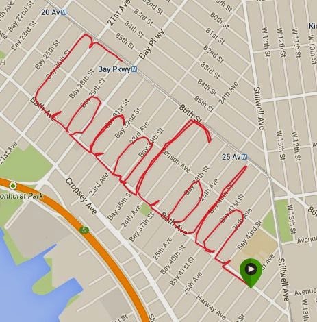
The first screen below is the usual GPS art made with my Garmin Forerunner 210. Note that I live near the letter "L" and since I wanted to start "writing" and running ASAP, I "wrote" the phrase backward, starting with the second "a" going from east to west. It took about 1.5 hours to traverse the 8.37-km course. I made a booboo with the leftmost "C", the curve should come down into Bay 28th Street but I was at the end of the run and was not thinking straight. I always do these runs from memory, with occasional checking of the map on my smartphone, never with a piece of paper in hand or the course already marked. Maybe I should, to avoid these little mistakes.
 |
| Runtastic map with speed info and mile markers. |
Runtastic maps do not have to be shown that way. It's just the default view. I played around with the map via a web browser on a real computer, i.e. not on a smartphone or the like, and was able to show just the path itself. No elevation, no speed, no markers. The route even shows in red, like Coca-Cola's color!
I hope Gene and Charity Miles will get the Coca-Cola sponsorship!
 |
| Runtastic map without extraneous info. |

No comments:
Post a Comment