Showing posts with label Calvert Vaux Park. Show all posts

01 September 2014

SCENES FROM A RUN: THE OLD NEIGHBORHOOD OF BATH BEACH ETC

With my current work hours of 8 AM to 5 PM, I have a very small window to run early in the morning.  As such the runs are shorter and limited to the streets closer to home.  In recent weeks, I was away in Boston for work then just had a week in the Lincoln, New Hampshire area for leisure.  While I had a few runs in both places, I should have resumed running once I got back but I got lazy, until today.  I got up late, past 9 AM, the weather was already hot, but it had to be done.  I got to re-visit some old places in my neighborhood of Bath Beach to see what's up with them.

Contrary to what a neighbor and Facebook friend told me, the waterfront area of Calvert Vaux Park is not open to the public yet.  At one time the fence's gate was knocked down, supposedly large enough for pedestrians but unwelcome to vehicles.  The fence is up again and the sign reminds the reader that soil contamination is in progress, enter only if authorized.
If you really have to get into the waterfront area of Calvert Vaux Park, there is another breach in the fence.  There is a beaten path right inside the fence so others have trespassed.  I'll stick to iTrespassing, not the physical type.
More welcoming is the Brookyn Bay Center, that area around the upcoming B.J.'s Wholesale Club on Shore Road.  No one was around and there was no gate whatsoever so I took a stroll to the new waterfront area behind BJ.
Not much of a running route but it adds maybe a kilometer to the waterfront area.  I am sure the place will be packed once the wholesale club opens in a few weeks.
Front behind BJ, one can see the Verrazano Bridge in the distance, Staten Island on the left and Brooklyn on the right.  The tall buildings near the bridge on the Brooklyn side is the Veteran Administration Building near Fort Hamilton.  The white building on the right, close to the foreground, is the side of Kohl's in Caesar's Bay.
I thought of running to the foot-bridge near 17th Avenue but it got hot so I turned at Bay Parkway.  I noticed that Vitamin Shoppe will take place of the old HSBC building.  Somehow HSBC never made it back after Hurricane Sandy.
This gyro place used to be called Olive Garden when it first open.  The real Olive Garden probably had some lawyers visited them and now the name is different.  Note the different patches of green on the awning.

21 January 2014

CUSTOM GOOGLE MAPS WITH PHOTOS

I love Google, I love maps, and I love Google Maps.  I especially love Google Maps with the Photos Overlay.  You have a Google Map then with a layer selected, you can see certain places that have photos associated with them, usually via Panoramio.  In the screenshot below, note that Photos and Labels are selected on the right.  Also Map is shown since we are already in Satellite mode.  Clicking on Map would remove the fancy view, no greenery, no actual road, etc, just a plain map with symbols and such, no photos-quality view.


It is easy to make your own maps based on Google Maps then add your own info.  Just find the place you are interested, such as Calvert Vaux Park in the screenshot below.  I found it, I clicked Save To Map, and I already have Calvert Vaux Park as one of my maps, otherwise I would select Create A New Map.


Last night I could almost swear that I once had a custom map with fancy photos that I easily added to.  It was not the case.  As you may recall from past blog posts I have, Calvert Vaux Park is now half-developed and is nowhere like what the Satellite view of Google Maps show.  I very much want to have my own map with my own photos.  It can be done, but it is nowhere as simple as clicking on some button in the map program and browsing to your photo of choice.  What you actually need to do is to go to the photo first, then right-click on the photo and select Open Image In New Tab.  (Open Image In New Window works too, Tab just happens to be my preferred choice of web viewing.)  Go to the new tab, highlight the entire URL (address bar) and press Apple-C (Ctrl-C on Windoze) to copy.


Next, go to your saved map, click Edit, choose the blue pin-drop and place it where you want to add the photo.  Give the pin-drop a title, click Rich Text, then Insert Image icon (which is right-most), and finally Apple-V (Ctrl-V on Windoze) to paste the link you copied earlier.


In the beginning, I used the very first URL when the photo was opened, whether in the album or not.  It didn't work.  There would be an icon but no photo.  First open the photo in a new tab or new window then you will be good.

It's a work-in-progress and below is the latest map I have so far of Calvert Vaux Park.  I really want to add some photos to highlight the wilder side of the park but it takes forever to find them in Google Photos, since the photos were taken some time ago and scrolling back in time is pretty hard.  Play around with zooming and panning, then click on each pin-drop to see the park at that location.


View Calvert Vaux Park in a larger map

12 September 2013

SCENE FROM A RUN: SAND SPURS!

Wednesday, September 12, 2013:  I finally found the time to go for a run.  I wanted to have a run as soon as I came back from the road trip, but Saturday I wanted to sleep in, Sunday actually got up at 4:30 to be able to make it at 6 at the Susan G Komen 5K in Central Park, Monday was the first day of school and I also got dragged into some other unpleasant task, Tuesday was Primary Day during which I worked 5 AM to 10 PM...  For me, it's extra difficult to run any time other than in the morning...

Some weeks ago, during a walk with my son, I re-encountered a plant that had prickly pods that easily attach to anything they come into contact.  It was at the beach of Narrows Bay, the northern side of Coney Island, facing the Verrazano Bridge.  The beach used to be really dirty and full of garbage, but it improved in recent years.  I wanted to re-visit the beach to take better photos of this exotic, IMHO, plant and its pods.

On the way to the beach, I passed by Calvert Vaux Park, which made gruesome news just last week.  A skilled hobbyist of model helicopter lost control of the machine and killed himself.  I never knew those things can be so deadly.  One time I even took my son to Marine Park's model airfield in Gerritsen to watch the planes take off and fly about.  Granted accidents with model planes are rare, it is possible.  Next time I am near these things I'll have a helmet on or be under a tree.

Construction continues to happen in other parts of Calvert Vaux Park.  A waterfront is coming about on the side across from Six Diamond Park and Home Depot.  I spied a jutting section with wooden rails.  Perhaps it will become a rest area with benches and such.  On the lot adjacent to the existing park that includes the more modern futbol field, I saw that things were looking better.

After Calvert Vaux, I visited the trail that mostly wraps around Home Depot.  I like to visit it at least once a week to help stomp down the weeds that slowly takes over the place, especially near the locked gate behind the metal junk yard.  Probably a lesson in futility, but it's a nice and quiet spot to add distance to the run.

I next ran along Neptune Avenue toward Mark Twain I.S. and on to the Poor Man's Beach on Coney Creek.  It took little time to find a bush of sand spur plant to pass my feet through to collect the pods.  I didn't know what they were called, but a post on FB later in the evening and my friend Rachel got the info.  Supposedly they are a pain to deal with, pun intended, and most web articles were about how to get rid of them.  "Sand spur", what an appropriate name.

Makeshift memorial for Roman Pirozek Jr. in Calvert Vaux Park, http://www.nytimes.com/2013/09/06/nyregion/remote-controlled-copter-fatally-strikes-pilot-at-park.html?_r=0
Beyond the fence, looks like a little rest area on the waterfront of Calvert Vaux Park.
A new section of Calvert Vaux Park almost ready for the public?

Sand spur plants!  The seed pods are prickly and easily attach to anything they come into contact with...
...such as the sock and sneaker of some runner, who did it all in the name of science.


15 July 2012

CALVERT VAUX RE-VISITED

Since I published the post about the newly opened Calvert Vaux Park, I re-visited it twice, each time seeing something I missed the last time.  All good!

A mist-spraying station, like those found in amusement parks, how cool is that!  I actually used this very same one, with my son, when we came to the park for him to target-shoot with his toy shotgun.
The park does have a restroom after all.  In passing by the trailer, I told my son that I thought this would be it, and he told, "It is!  It says 'MEN' on it."  Sure enough, the door was even unlocked and I peeked inside.  From the lack of smell, it seems the facility was not heavily used yet.  In going back to my photo from a few days ago, I was glad to know that the trailer was not labeled as a restroom at the time.  For a moment, I thought I have lost it!
Dating couples can use the semi-circular bench in the dead-end to steal a kiss, or some gun-loving kid can be prone on it to shoot at empty containers.  Standing on the bench, I spied a pond a few feet to the left of the bench.

14 July 2012

INSIDE CALVERT VAUX PARK

Not long after I wrote about the lack of info on the opening of Calvert Vaux Park, the park actually became accessible to the public.  Much as I like to think that I had some influence on the process, I am sure it's just a coincidence.


I do not know when the park opened to the public, but on July 4, during a run, I saw that there was much activities by park staff.  Weed-whackers were used by staff in clear, plastic overalls.  Other staff members were on hands and knee in some places to remove the weeds among what was planted.  The east gate was opened to admit trucks carrying heavy equipments.  One machine looked like a zamboni, perhaps used scrubbing hard surfaces.

I asked a park personnel when the park would be open to the public and he answered, "Soon, very soon."  I automatically dismissed his answer as something his manager had told him to say.  Little did I know that the man was telling the truth. Maybe on Saturday 7 July the park started to admit the public.  I would not know since for my post-lunch walk on that day I opted to go to Kings Highway instead of Calvert. I already gave up on waiting for it to open. Let it be a surprise, something that I don't think about but happens anyway.


Sunday 8 July, evening, sun was already down but the sky was still somewhat lit, I decided to have my post-dinner walk to check out Calvert Vaux. Lo and behold, the gate near the footbridge was open. Not wide open, but at least it was not locked and there were no people inside working. It was finally open to the public! I quickly went inside and looked around. A small group of people was on the futbol field, so I was not the only person there. It was already dark so I did not take photos. I knew where I would run the next morning.


I did run in Calvert Vaux Park the next day and took the photos below. After all that waiting, I was a bit disappointed that it was not large. If you do not mind running the same path over and over then it is OK. Perhaps some day the back fence will be open to connect the new park to the undeveloped area then you can have a long run. For now, it is best for walking and for adding distance to a route, but not as a running route by itself.

The open gate!  What a welcome sign!!!
I suppose the Mayor and other politicians were at Calvert Vaux Park for some ribbon-cutting ceremony in 2011.  To me, it was still opened to the public around July 4, 2012.  Don't let this plaque distort history.

The paths in Calvert Vaux Park do not all connect.  This one ends in a semi-circular bench, can be a romantic spot, if you don't mind being surprised by wanderers.
The southern end of the park.  Behind the photographer is a mesh fence, beyond that is the undeveloped part of the area that has a few more futbol fields and baseball diamonds, perhaps a homeless camp, too.
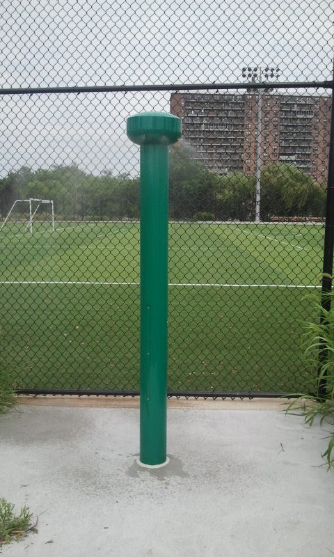
I was slightly surprised to discover that these water fountains actually worked.  Now that I am an avid runner, details like this are important features of a public park.
All these times looking into the park from the outside I did not this ditch existed.  Perhaps it was a natural stream and the architects wanted to preserve it.  There was no water flowing, that was for sure, but it still looks nice.
A goal-to-goal view of one of the futbol field.  The AstroTurf surface felt weird to run on, I'll avoid it.
The area is not near any subway stations although some buses probably run on Cropsey or maybe even Shore Road itself.  If you come by bicycle, you can chain it to this rack.
There is no public restroom at Calvert Vaux Park at the moment. Whether it's because of security reason or what else, I do not know.  I was hoping this trailer is the bathroom but there was no sign to indicate so.

This is probably a tool shack, not a restroom.  There is one in Scarangella Park near my home, too, must be a new thing for the parks.

26 June 2012

CALVERT VAUX PARK GREENWAY

With Google and such, you would think the web has information on everything.  That is not the case with Calvert Vaux Park, or at least its renovation.  Years ago I once took two nephews cycling there.  We rode as far as the water's edge.  I recall seeing a wide paved road with someone playing with a remote-controlled car.  There were some soccer players, too.  It rained a day or two earlier and on the way out we came across a flooded road.  Always up for an adventure, I encouraged the kids to charge right through.  I think they loved it.  It may be on this same bike trip that we also charged through some puddle-lake behind Home Depot.


If I recall correctly, Calvert Vaux Park then had two roads leading in and out of it.  There was a soccer field but not much else.  The wide paved road that I saw was far from the main road, Shore Parkway. A snapshop obtained via Google Maps confirms my faint memory, even though the captured image shows that construction already started.


When I started running seriously I needed new routes and wanted to re-visit the park but it appeared to be off-limit.  Some major renovation was started and the area was pretty much fenced off. It seemed like ages before the construction fence came down.  Sure the park looked nice but its gates were always locked.  There were no signs to indicate when it would be open to the public.  The Internet had nothing either.  I could see that only a portion of the park underwent renovation.  A large area closer to the water seemed to be left alone.  One day I decided to explore the undeveloped area.  One dirt road led into the area and there were signs of construction to come.  Some sections were fenced off and piles or stacks of construction materials laid here and there. I mostly run without my near-sight glasses and did not look hard to find any paths running toward the water.  On a second visit, I saw people heading for a baseball game.  The back area was certainly open to the public, it seemed.  One more run trip and I found a path to the water.  There was only a barrier to prevent cars from getting into the area.  A typical lithe runner could easily bypass the barrier.  There were no signs warning people not to enter so I walked past the obstruction.  There was a fork in the road and I took the left path.  A short distance later there was another barrier on the path, with many tree branches and such behind it.  The road seemed unpassable and I did not have much time left.  Gotta head back to shower and get to work.

Before I tried again to explore the waterfront of Calvert Vaux Park, I consulted Google Maps to get a better idea of the area.  From the outdated aerial photo, it seemed the right fork in the road was wider and connected to a path near the water.  That was exactly the case when I finally reached the waterfront.  What Google Maps did not show was a fallen tree that mostly blocked off the path.  Luckily, to the left of the path was just a grassy area that can be used to easily circumvent the downed tree.

There was no path that runs immediately along the water.  At the water margin, there is nothing to prevent anyone from jumping in or slipping in. The area was mostly wild alright. I ran along the narrow path near the water and it merged with the wider path eventually. I could have gone further but I was sure there was no exit that way. The path probably would end at the back of another construction area. I wanted no troubles and did not plan to trespass some off-limit area, so back I went.


Instead of the Fallen-Tree Path, I found the narrower path back to the second barrier. The path was actually blocked by tall grasses and would not join the wider path. Again, going around the tall grasses was easy, as the area was mostly open. Getting back to the "Left Fork" from behind the second barrier was easier than getting into it. Again it was time to head home and get ready for work. Maybe I will come back on a weekend, with baseball or soccer players in the area to feel safer.


The road appeared to be blocked but it was easily passable on the right.  I did not try to as it was time to head back.  On a later visit I came out to this side from the inside.


I could not help and wondered if anyone heard the sound of the tree falling.  The area was desolate.  Apparently not desolate enough for someone to place a wire trashcan in the midst of the branches...

There was no path to the water margin.  In the distance is the Verrazano Bridge.

If I kept taking this road (into the distance) I probably would end up behind some construction area that was off-limit to the public.

Years ago this was where I saw people parked their cars and someone playing an RC car.  I included the Verrazano Bridge in the picture to establish a point of reference.

The left fork in the road, after the barrier, would lead you here, where your journey would be blocked by the mass of brushes.  It is totally passable on the right though.

Somewhere in the short distance is the second barrier.